Structures
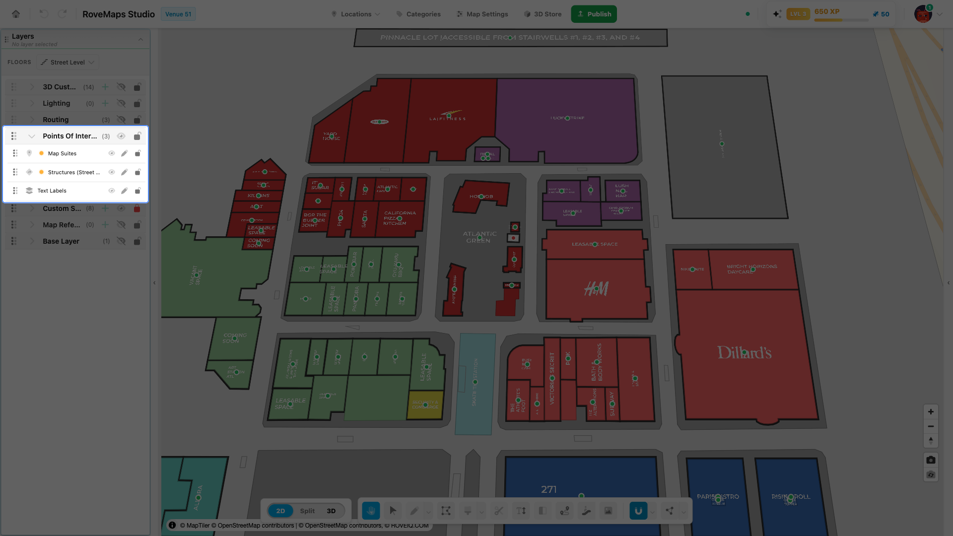
Structures are building or area footprints in the Points Of Interest group — the polygons that define the shapes visitors see on the map. Every structure carries two companions the editor keeps in sync: a map suite (the on-map label) and a door (the routing entrance). You select a structure to edit its shape, link it to a location, and control its label, logo, and color.
Overview
A structure is a polygon or multipolygon on a structures layer. Each floor has its own structures layer, and a structure renders only when the active floor is one of its assigned floors.
Every structure is linked to its companions by a shared identifier — the structure’s id matches
the suite_id on its map suite and doors:
- The structure owns the footprint and the building styling (color, height, opacity).
- The map suite carries the on-map title and label settings. On the map it renders as the structure’s title plus a small handle dot at the centroid — green when an activated location provides the label content, red when no location is linked.
- The door is the structure’s entrance — the point where routing paths connect.
A structure’s appearance resolves from the most specific setting available: location settings first (when a location is linked), then the map suite’s settings, then the venue defaults from Map Settings.
Add a structure
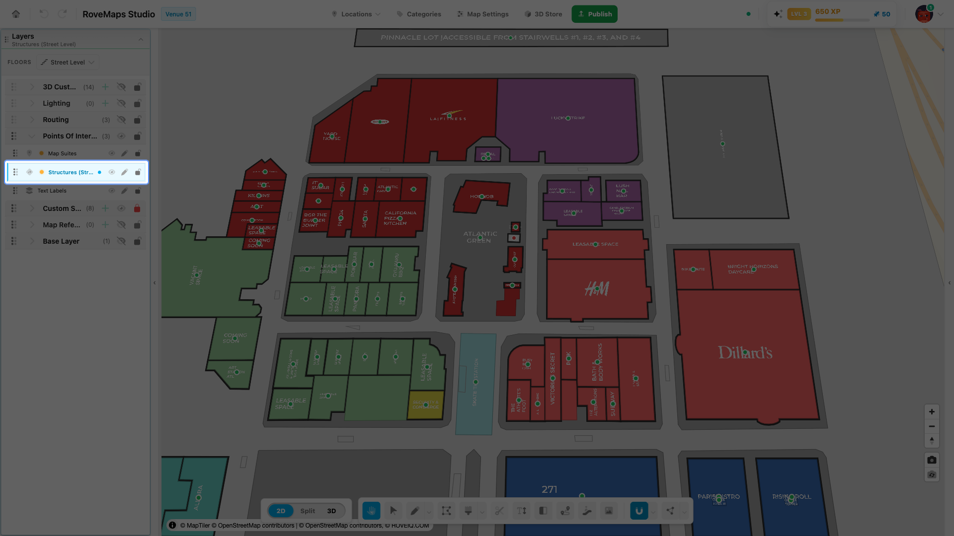
Draw a new structure to add a building or area footprint. Drawing on a structures layer creates three things at once: the structure, its map suite (the label), and a door at the centroid — all linked and created in a single step, so they always appear and undo together.
- Select the floor you want to draw on.
- Select a structures layer in the Layers panel. If no layer is selected, Draw auto-selects a structures layer for you.
- Activate Draw. Use the chevron on the Draw button to pick a sub-tool — Freehand, Square, or Circle — for the footprint shape.
- Draw the footprint:
- Freehand — click to place each vertex, then double-click to finish.
- Square — drag a rectangle; hold Shift to constrain it to a square.
- Circle — drag from the center outward.
- Finish a freehand footprint by double-clicking, right-clicking, or pressing Enter.
Notes
- A footprint needs at least three vertices.
- Draw stays active after a footprint is finished so you can keep adding structures.
- The new structure’s handle dot is red until you link a location — see Link a location.
Publish impact: new structures stay in your draft until you publish. On Publish, the structure, its map suite, and its door are all sent upstream, grouped under their layer types in the publish preview.
Edit a structure
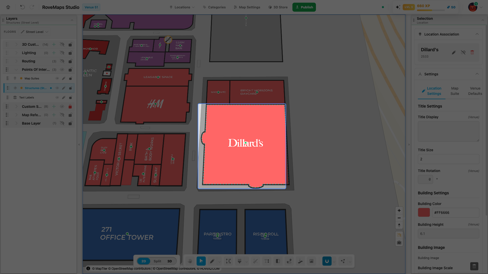
Click a structure with Select to select it. The structure shows the editor’s dashed selection outline, and the structure panel opens in the right drawer with its location, settings, and label controls.
- Move it — with Select, click the middle of the footprint and drag it to a new position.
- Reshape it — double-click the structure to enter edit mode and drag its vertices, or switch to the Vertex Tool to edit vertices directly.
- Delete it — see Delete a structure.
Publish impact: structures are layer-level: an edit to any structure marks the whole layer as modified, and the layer publishes as one change on Publish.
Delete a structure
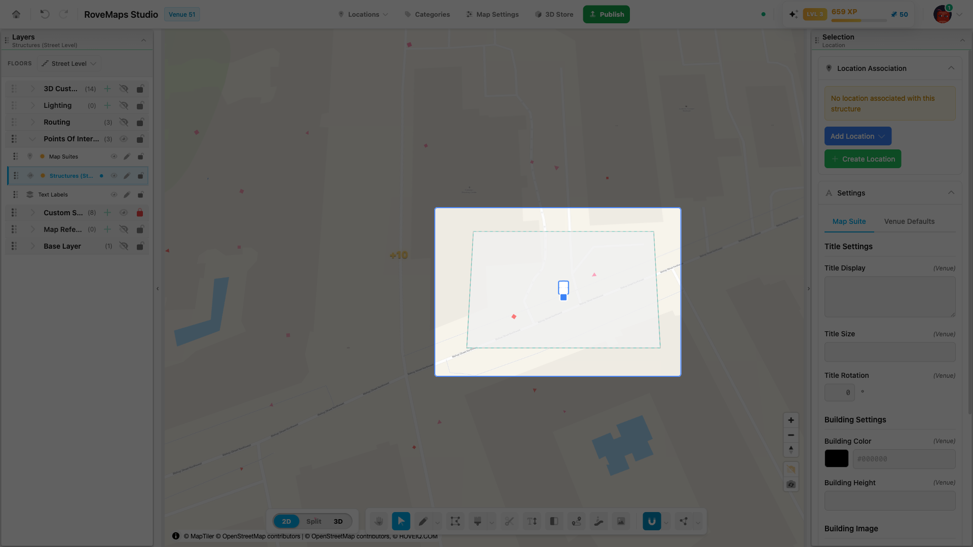
Deleting a structure removes its companions with it — the map suite and doors go in the same step, so nothing is left orphaned on the map.
- Pick the Select tool and click the structure to select it.
- Press Delete (or Backspace). The structure, its label, and its doors are removed together.
Notes
- A linked location record is not deleted with the structure — it stays available in the Add Location list to link to another structure.
- Deleting can be undone with Ctrl+Z while you are still in the editor.
Publish impact: the deletion stays in your draft until you publish. On Publish, the structure and its companions are removed from the live map. A structure that was never published is simply removed from the draft.
Link a location
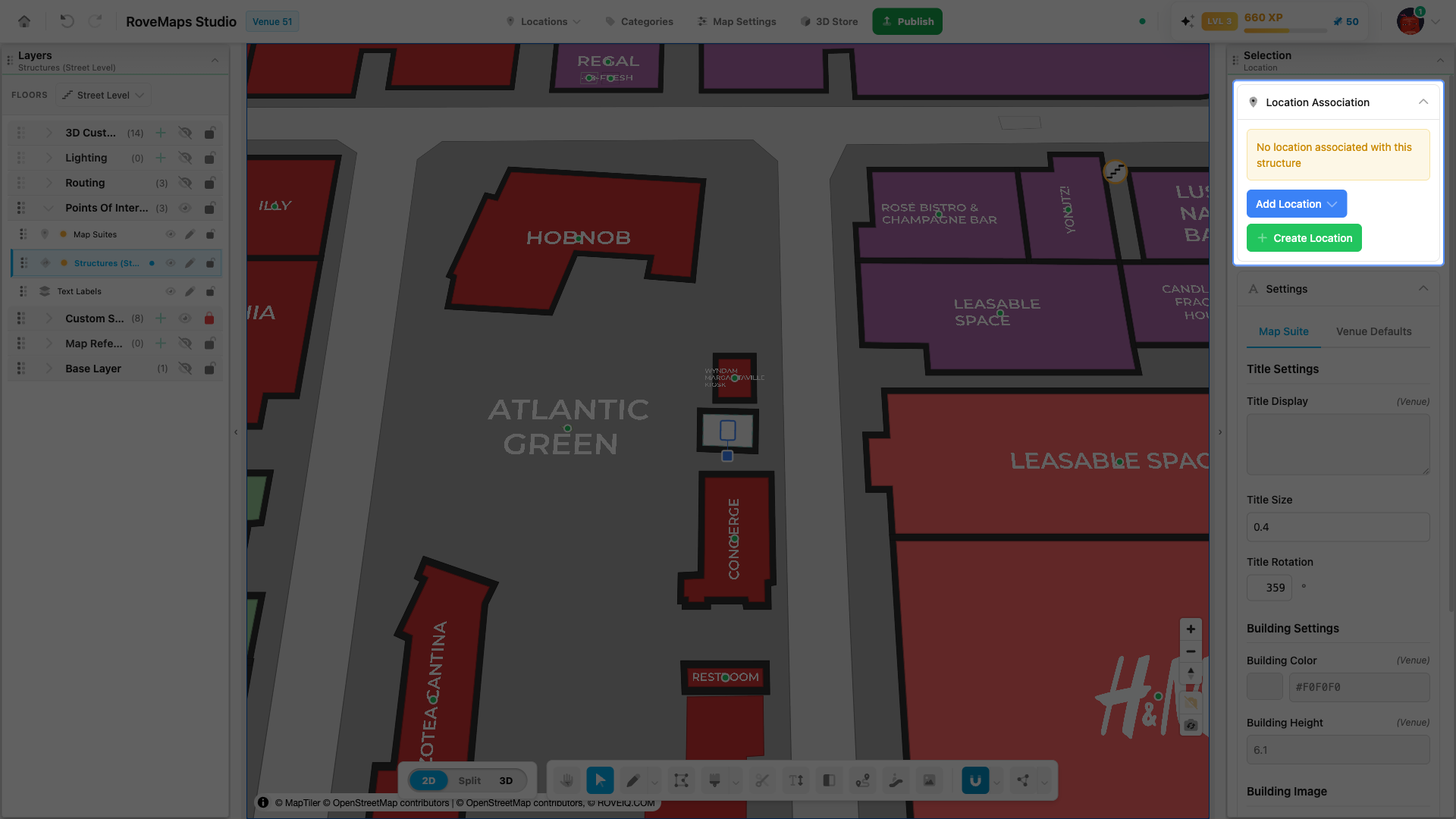
Linking a structure to a location connects it to location data — name, visibility, title display, and location-level styling. Once linked, the structure’s label and building style resolve from the location first, and the suite’s handle dot turns green. Each structure holds one location association.
- Select the structure with Select to open the structure panel.
- Expand the Location Association section. It reads “No location associated with this structure” until one is linked.
- Link an existing location or create a new one:
- Add Location — click Add Location, search by name, and pick a location from the list.
- Create Location — click Create Location to make a new location record and link it to this structure in one step.
- If the chosen location has a saved title position, a prompt asks whether to move the structure’s label to that position. Choose to move it or keep the current label position.
Notes
- Linking updates the location record, the structure, and its map suite together, so the label and building style update immediately on the map.
- To change which location is linked, remove the current association first — see Unlink a location.
Publish impact: the link stays in your draft until you publish. On Publish, locations are sent as their own records, and the structure and suite publish as their own changes.
Unlink a location
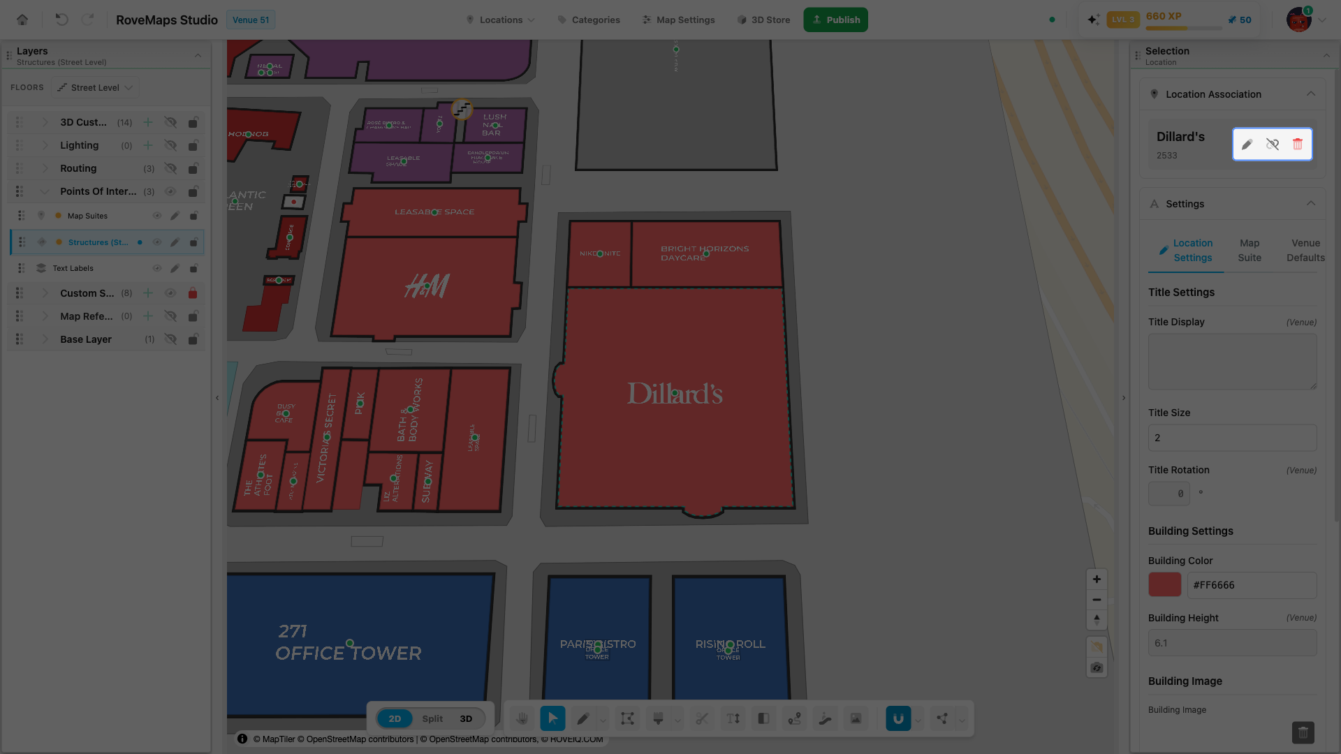
Removing the link unbinds a structure from its location without deleting the location record. The structure reverts to its default styling, and the location remains available to link to other structures.
- Select the linked structure to open its panel and expand Location Association. The linked location’s name is shown with edit, unlink, and delete actions.
- Click the unlink (link-slash) action — Remove Location Association.
- In the confirmation dialog, click Remove Association.
Notes
- After removal the structure reverts to its default building style and label, and the location record is kept — it still appears in the Add Location list to link again later.
- The trash (Delete Location) action is different: it deletes the location record itself, unbinds it from every structure it is linked to, and removes the record on publish. Use Remove Location Association when you only want to break this one link.
Publish impact: removing the association stays in your draft until you publish. The location record is kept, and the changed relationship is sent with the structure and suite on Publish.
Update the label text
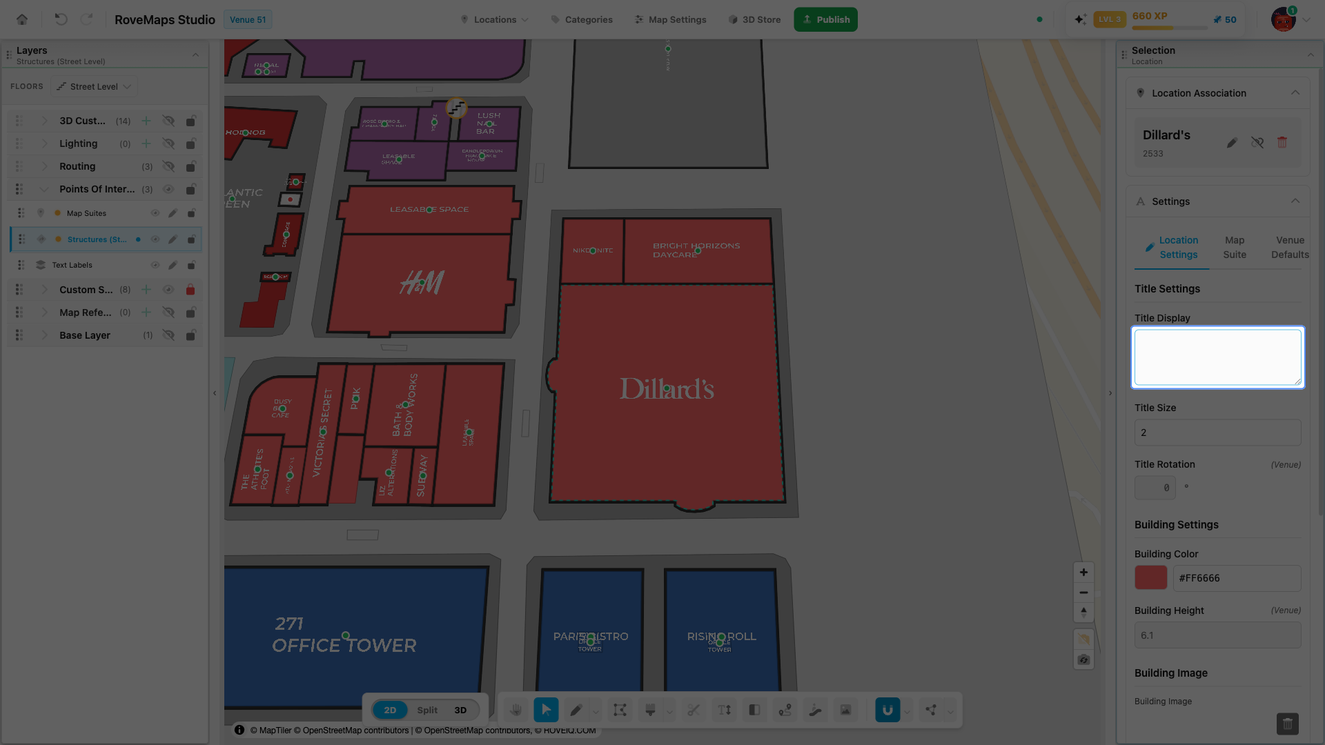
The text shown over a structure is its label’s Title Display. When you link a location, the label shows that location’s name — edit Title Display to change what renders on the map.
- Select the structure with Select to open the structure panel.
- Expand the Settings section.
- Choose the level tab: Location Settings (available when a location is linked) or Map Suite.
- Edit Title Display. The label on the map updates with your change.
Notes
- A structure with no activated location shows no label — its handle dot is red. Link a location first; see Link a location.
- Settings cascade: a value on Location Settings overrides Map Suite. Use the field’s clear control to remove an override and fall back to the inherited text.
Publish impact: the text change updates the location record or the map suite in your draft and publishes with it on Publish.
Resize, rotate, and move the label
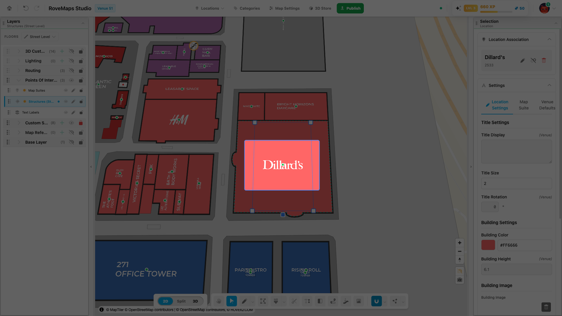
A structure’s label has its own size, rotation, and position, independent of the footprint. You can transform it directly on the map, or set exact values from the panel.
On the map — click the label to select it. Transform handles appear around the text:
- Move — drag the label (or its small handle dot, which grows when you hover it) to a new position.
- Resize — drag the corner handle to make the text larger or smaller.
- Rotate — drag the rotation handle to spin the text to any angle.
- Press Escape or right-click during a drag to cancel it.
In the panel — select the structure, expand the Settings section, choose the level tab (Location Settings or Map Suite), and set Title Size and Title Rotation as numbers.
Notes
- The two stay in sync: dragging the on-map handles updates Title Size and Title Rotation in the panel live.
- Settings cascade: a value on Location Settings overrides Map Suite. Use the field’s clear control to remove an override and fall back to the inherited value.
Publish impact: label changes update the suite (or the location record) in your draft and are sent upstream on Publish.
Add a building logo
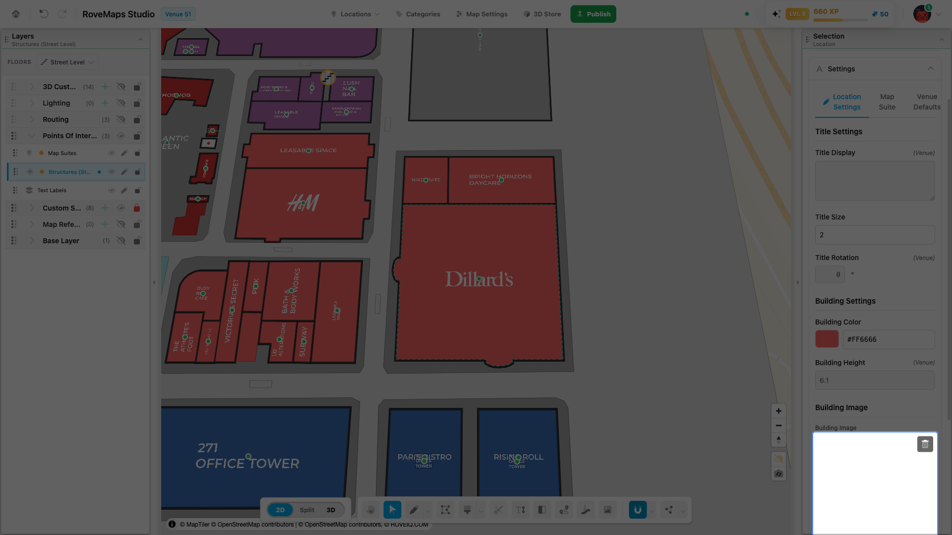
A building logo renders on the structure in the 3D view. You set it with the Building Image control, on the linked location or on this structure’s map suite.
- Select the structure with Select to open its panel.
- Expand the Settings section.
- Choose the tab to set the image on: Location Settings (available when a location is linked) or Map Suite.
- Under Building Image, drop an image onto the box or click Browse… to choose a file. The image uploads and a preview appears.
- Adjust Building Image Scale if the image needs to be larger or smaller on the building.
Notes
- The building image renders in 3D — switch to 3D or Split to see it; see View structures in 3D.
- Settings cascade: a location-level image overrides the map suite’s, which overrides the venue default. Use the clear control or the preview’s trash button to fall back to the inherited image.
- Add by URL appears when a higher level already provides an image, letting you override it with an image URL.
Publish impact: the building image is stored on the location (or map suite) in your draft and is saved upstream on Publish.
Split a structure
Splitting a structure into two structures is coming soon.
Update the door entrance
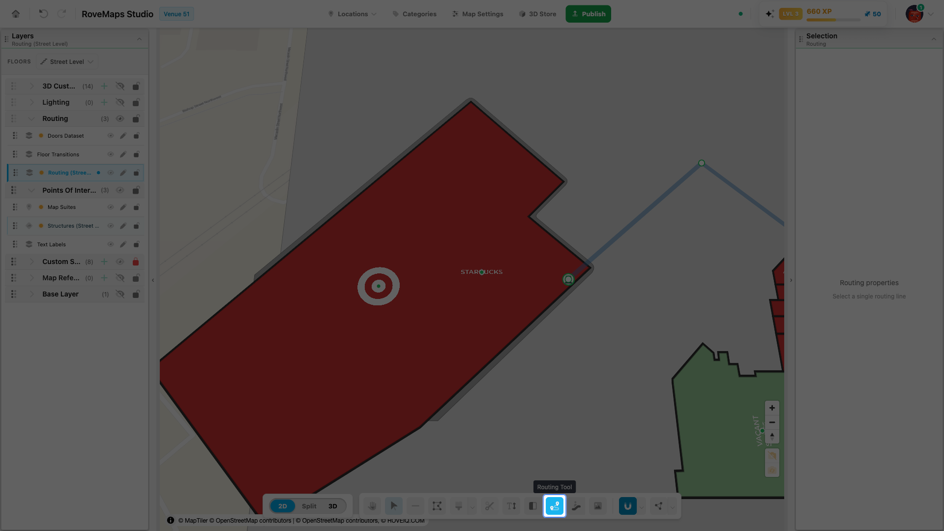
A door is the point where routing paths connect to a structure. You move a door by dragging a routing path vertex onto the structure with the Routing Tool — the door snaps to where you drop the vertex. There is no separate drag handle on the door marker itself.
- Open the Routing Tool.
- Turn on Doors in the Layers panel so you can see the door update — it is hidden by default.
- Drag a vertex of a routing path over the structure whose door you want to move. The structure outline highlights to show it is the drop target.
- Release the vertex on the structure. The door moves to the exact drop point, and the editor recomputes routing connections so the door’s status color refreshes.
Notes
- The dropped vertex must land on a structure that has an associated door. If the structure has no door, nothing moves.
- Only the matched door moves — other doors and the path’s other vertices stay put.
Publish impact: the moved door stays in your draft until you publish. On Publish, it is sent as its own feature-level change and stays linked to the structure it belongs to.
View structures in 3D
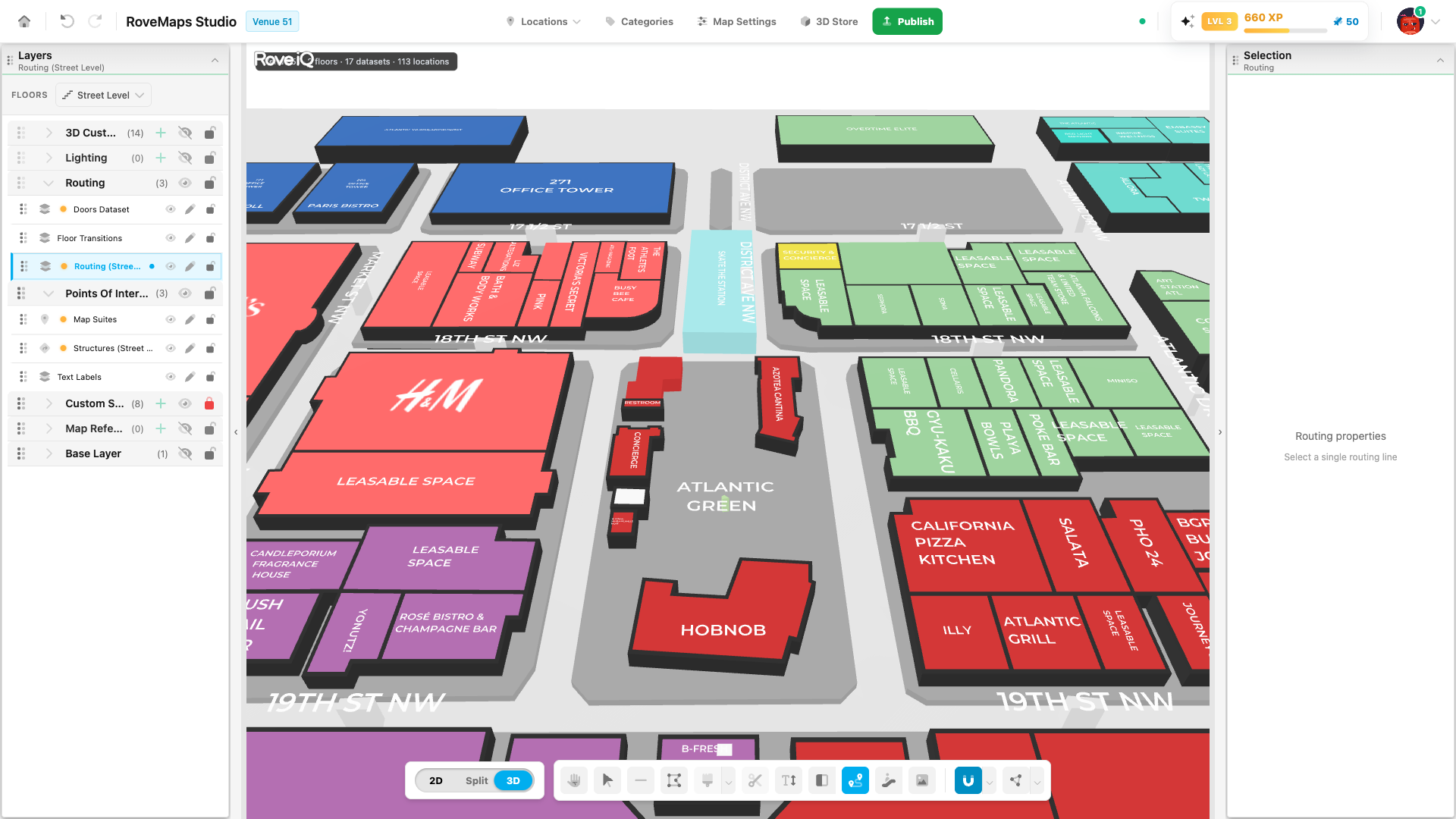
Structures are extruded by their building height and base height, which is flat in the 2D map. Switch the editor to the 3D view to see structures as extruded buildings with their height, color, and logo. This is a viewing change only — it does not edit your draft.
- In the editor toolbar, find the view control with 2D, Split, and 3D segments.
- Click 3D to show only the 3D scene, or Split to show the 2D map and the 3D view side by side.
- Your structures render as extruded buildings using their resolved building height, base height, and color.
Notes
- Split and 3D stay locked until the required 3D setup steps are complete. 2D is always available.
- The 3D view reflects your unsaved draft edits, so footprint, height, and color changes appear without publishing.
Glossary
- Structure — a building or area footprint: a polygon on a structures layer that owns the building styling.
- Map suite — the structure’s on-map label. Created with the structure, linked by
suite_id, and rendered as the title plus a small handle dot. - Handle dot — the small dot at the label. Green means an activated location provides the label; red means no location is linked. It is also the grab point for moving the label.
- Door — the structure’s entrance point, where routing paths connect. Created with the structure.
- Location — a record carrying name, visibility, and styling. Linking one to a structure gives the structure its label content and location-level styling.
- Location Association — the structure panel section where you link, edit, unlink, or delete the structure’s location.
- Settings cascade — how appearance resolves: location settings first, then map suite settings, then venue defaults from Map Settings.